The Northern School of Permaculture
You are here
Site Data for Whitehouse Farm
Provisional information
(Please check for yourself before quoting this.)

OS Grid Reference: SD 73945 89665
Latitude 53.404
Longitude -2.394
Elevation above sea level:
Level ground, about 27m
Distance from sea: 50km (estimated)
Area of property: 2 acres (approx)
Aspect: (flat) buildings to the south
Slope: effectively level ground
Climate zone: Cool Temperate
Annual rainfall: 890mm (estimated) heaviest in December and January, also heavier, to a lesser extent, in June/ July/August
Rains for at less than half the days in the month in winter and 10-11 days per month in summer.
Average winter temperature 4-6 degC
Frosts likely from November to end of April (gardenfocused.co.uk for Warrington)
Average summer temperature 12-16 degC
Annual hours of sunshine: 1400 (estimated)
Climate extremes: data not available at time of writing
(Weather info from Jodrell Bank and Met Office)
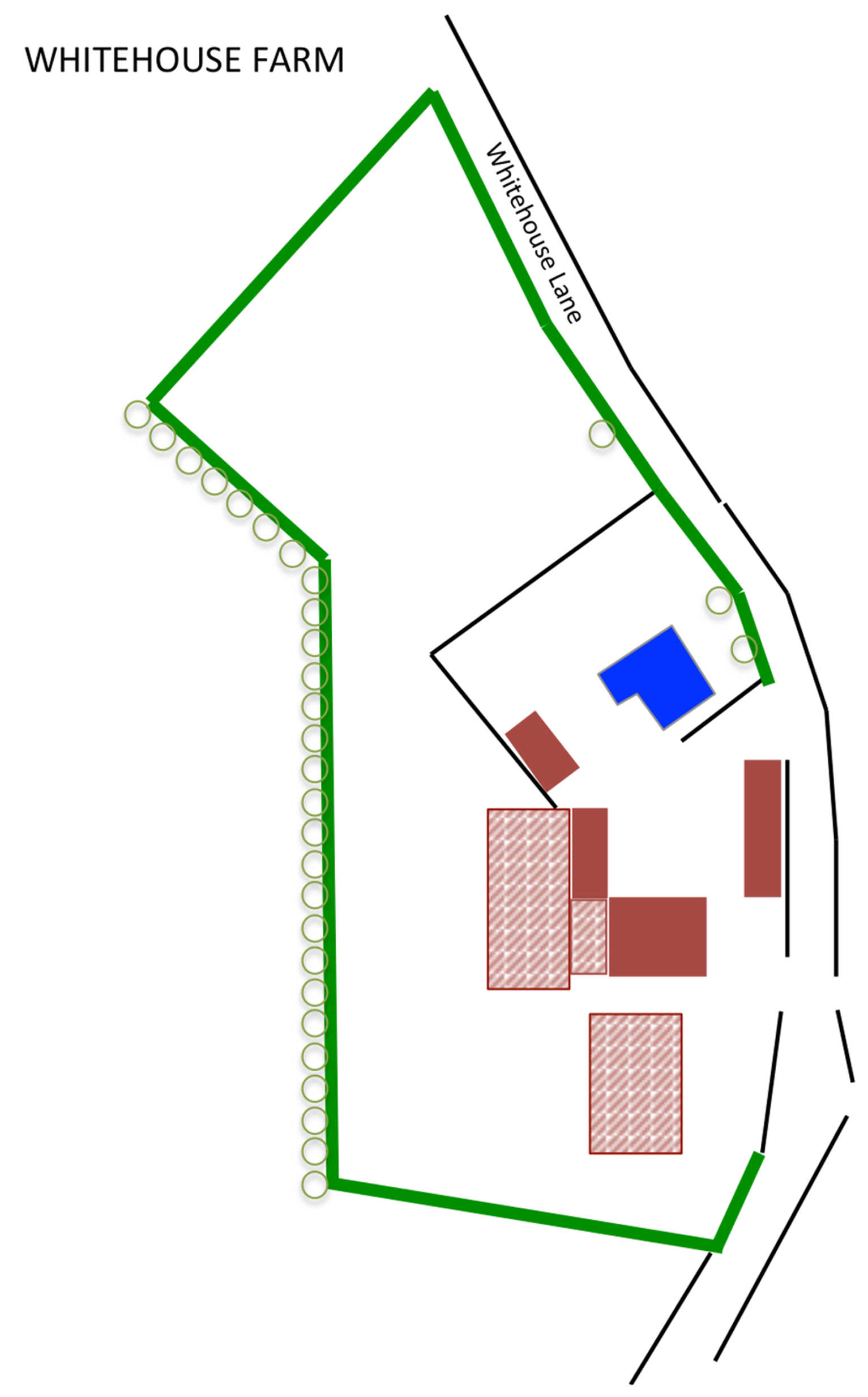
Site Maps
 We are bringing some copies of paper maps, sized A4 and A3, to use on-site. If you want to process any of the maps yourself you may try these:
House/Farmyard base map A3 (jpg)
House/Farmyard base map A4 (jpg)
Basemap sketch (as opposite, jpg)
More information about Ordnance Survey (OS) references
Latitude and Longitude conversion to OS grid references
Theme by Danetsoft and Danang Probo Sayekti inspired by Maksimer