The Northern School of Permaculture
You are here
Site Data for Dean Royd Farm
Provisional information
(Please check for yourself before quoting this.)

OS Grid Reference: SD 94026 21179
Latitude 53.867
Longitude -2.091
Elevation above sea level:
Lowest 165m
Highest 245m
Farmhouse 200m
Distance from sea: 60km (estimated)
Climate zone: Cool Temperate
Annual rainfall: 970mm (estimated) heaviest in December and January, also heavy in July/August
Usually rains for at least half the days in the month
Average winter temperature (lower valley) 2degC
Frosts likely from November to May
Average summer temperature (lower valley) 16deg
Climate extremes: data not available at time of writing
Area of property: 31 acres (approx)
Aspect: south westerly
Slope: steep, with cliffs and plateaus
Site Maps
More information about Ordnance Survey (OS) references
We are preparing paper maps, sized A3 and over, to use on-site. If you want to process any of the maps yourself and you find that the following files are not of a high enough quality, you may contact us and ask for higher resolution files.
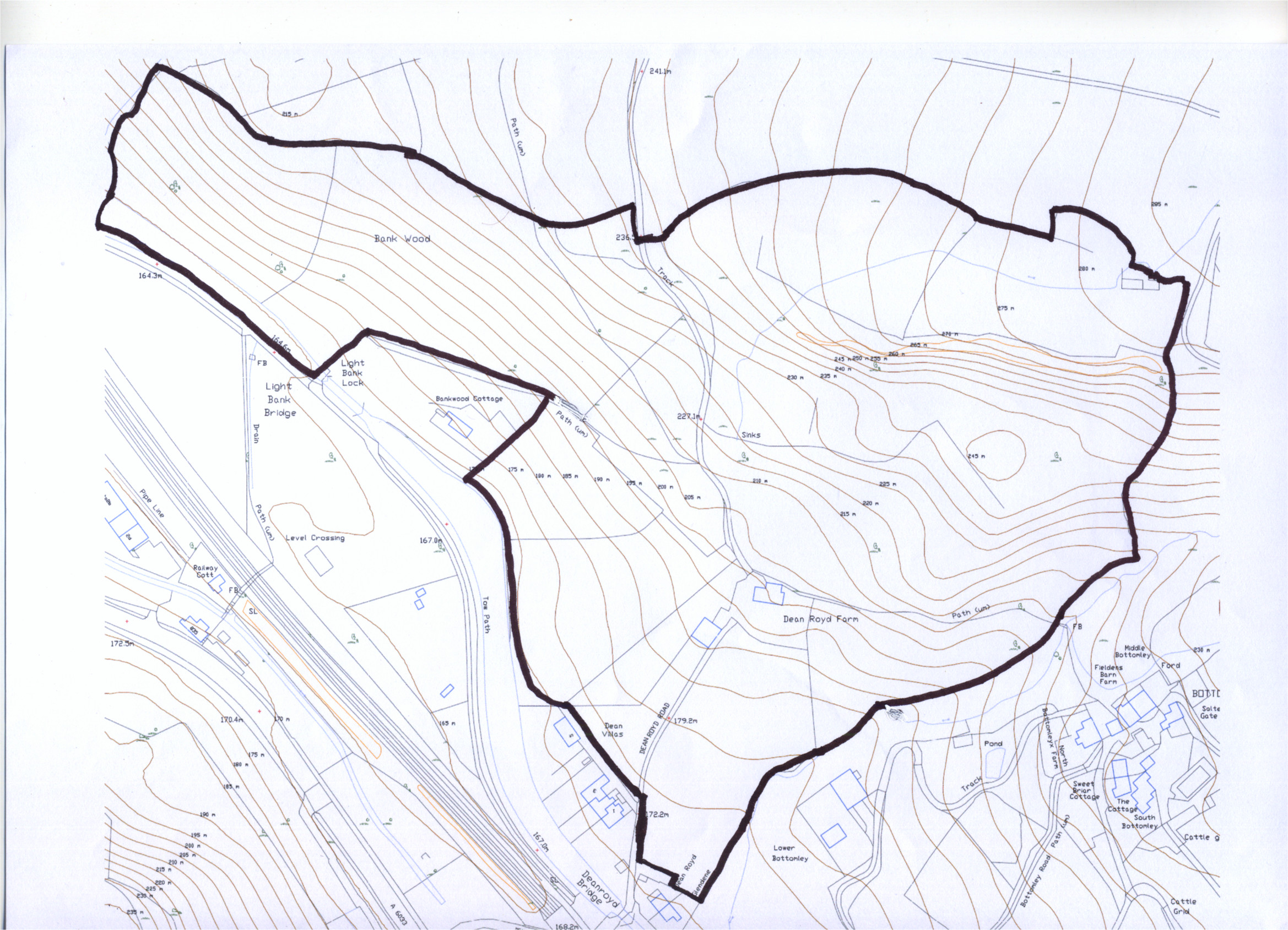 Site base map (jpeg, 1MB)
OS map (jpeg, 1.2MB)
Site map provided by client (pdf, 180kB)
Detailed contour map (high res) (pdf, 486kB)
Theme by Danetsoft and Danang Probo Sayekti inspired by Maksimer